Toasty temps swell into Easter weekend
Clouds build in by Easter Sunday, but rain chances remain at bay through the weekend.
Easter bunnies don’t sweat – but they may wish they could this weekend. Highs will soar into the upper 80s Saturday afternoon as stiff winds continue to shove their way into the Carolina from the southwest. More clouds build into our area by Easter Sunday, but there we’ll remain rain-free through the holiday weekend as highs cruise well into the 80s once again. The heat continues into the start of the workweek before noticeable changes come to your weather-wise forecast.
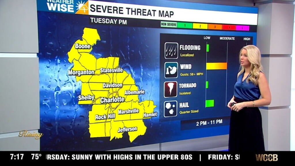
A weak cold front will approach the Carolinas from the northwest by Tuesday afternoon, bumping up scattered shower and storm chances for our second day of the workweek. While Tuesday isn’t looking like a washout, the incoming front stalls just to our north, allowing for moisture to pool into the WCCB Charlotte viewing area through midweek. As humidity levels rise, we’ll want to watch for pop-up afternoon storms – much like we would on a summer day. Temperatures may cool into the 70s on Tuesday before jumping back near 80° for much of the week ahead.
Tonight: Mostly clear. Seasonably mild. Low: 60°. Wind: SW 5-15.
Saturday: Mostly sunny early, then variable clouds. Very warm. High: 88°. Wind: SW 5-15. Gusts: 20+
Saturday Night: Partly-to-mostly cloudy. Even milder. Low: 64°. Wind: SW 5-10.
Easter Sunday: Mostly cloudy. Remaining warm. High: 86°. Wind: SW 5-10.