Summer weather arrives with the chance for storms
Dodging scattered storms
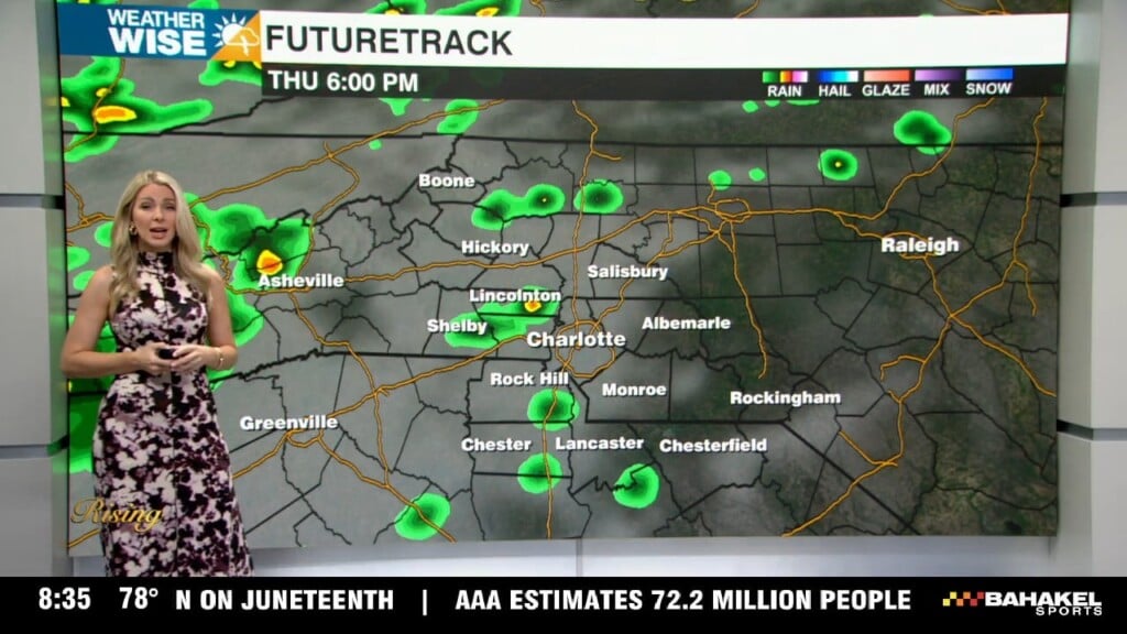
The warmer temperatures, rising humidity, and even a few storms yesterday reminded us that September can feel more like July. That trend continues the next couple of days as Charlotte reaches the 90s for the first time since August 18th, today and tomorrow. The High Country will enjoy slightly cooler weather with afternoon temperatures near 80. Friday looks pretty dry, but don’t rule out a stray afternoon storm. Our next real weather maker is in sight as a cold front approaches the area by Saturday evening.
Saturday will again be hot with temperatures reaching the lower 90s in Charlotte, and upper 70s in the High Country. As a cold front approaches, rain chances will rise. Expect isolated to even scattered showers and storms Saturday afternoon and evening. I wouldn’t cancel any plans, but have a backup for any outdoor plans. It won’t be a washout, but do be mindful that any storms that do form could pack a punch with heavy rain, lightning, and gusty winds. By Sunday, we begin a cooldown that lasts into early next week. Rain chances Sunday are lower than Saturday, but it looks cloudy, and some rain is possible south of I-85.
Meanwhile, the tropics are showing signs of life as we monitor newly designated Invest 91L. This has a high chance of developing into Gabrielle over the next couple of days. It’s too soon to know exactly where this eventual storm will go, but any impacts to the United States would be 10+ days away!
Friday: Mostly sunny. A stray PM storm. High: 90°. Wind: SW light
Friday Night: Mostly clear. A stray storm early. Low 69°. Wind: calm
Saturday: Mostly sunny. Scattered PM storms. High: 91°. Wind: SW 5-10
Saturday Night: Mostly clear. An isolated storm. Low: 69°. Wind calm