Wet Start to Workweek, Cold Blast Inbound
Some measurable snow may fall across elevations above 3500' on Tuesday.
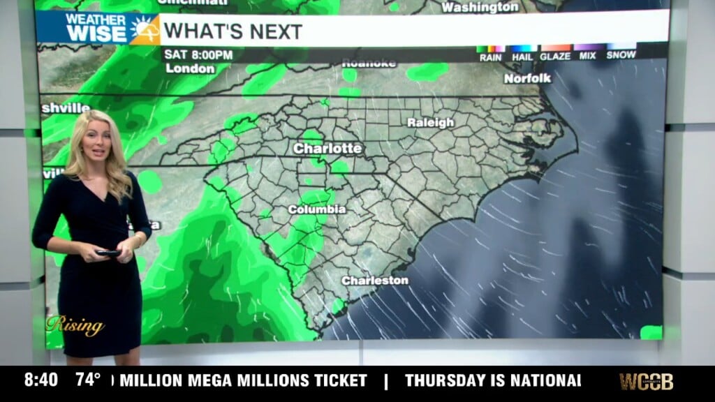
Mainly sunny skies and above-average temperatures have carried us into the second half of the weekend, but don’t expect the good times to roll into the workweek. A robust area of low pressure has developed over the northern Gulf of Mexico and will bring us heavy rain late Sunday night into Monday. Most of the Piedmont can expect 1-2″ of rain to fall through the early afternoon hours on Monday, most of which will fall between midnight and 8 AM. While the severe threat is low, some gusty damaging winds are possible with a few storms. A separate cold front will sweep into our area as the rain passes, forcing temperatures off of a cliff as we head into Tuesday. Some measurable snow is possible in elevations over 3500′, while a few flurries may make it into the Foothills and northwestern Piedmont. Expect to wake up in the 20s and teens Tuesday and Wednesday morning before temperatures recover slightly in the back half of the workweek.
Tonight: Cloudy with rain, heavy at times. Low: 54°. Wind: SW 5-10.
Monday: Rain tapers off, sunshine returns. High: 58°. Wind: N 5-15.
Monday Night: Variable clouds. A stray shower or flurry is possible. Low: 32°. Wind: NE 5-10.
Tuesday: Cold sunshine. High: 46°. Wind: SE 5-10.