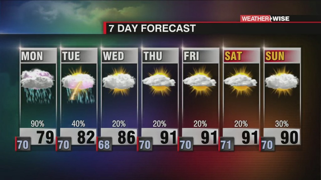
Cooler, Wetter Start to Workweek
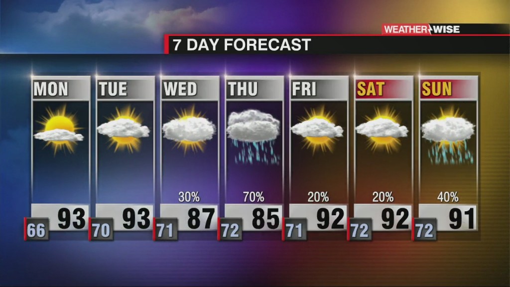
Some relief from the heat arrives Monday as an expansive rainmaking system sweeps into the Carolinas.

Some relief from the heat arrives Monday as an expansive rainmaking system sweeps into the Carolinas.
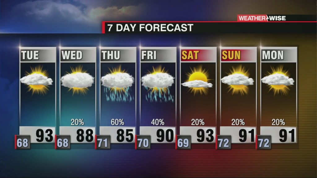
Saturday was one of the hottest days we've seen all year, but a much-needed wet cooldown is on the way.

Over two months worth of rainfall has fallen in just two days as water levels continue to rise.
Oregon's Bootleg Fire has burned over 200,000 acres and is currently the largest wildfire in the nation.
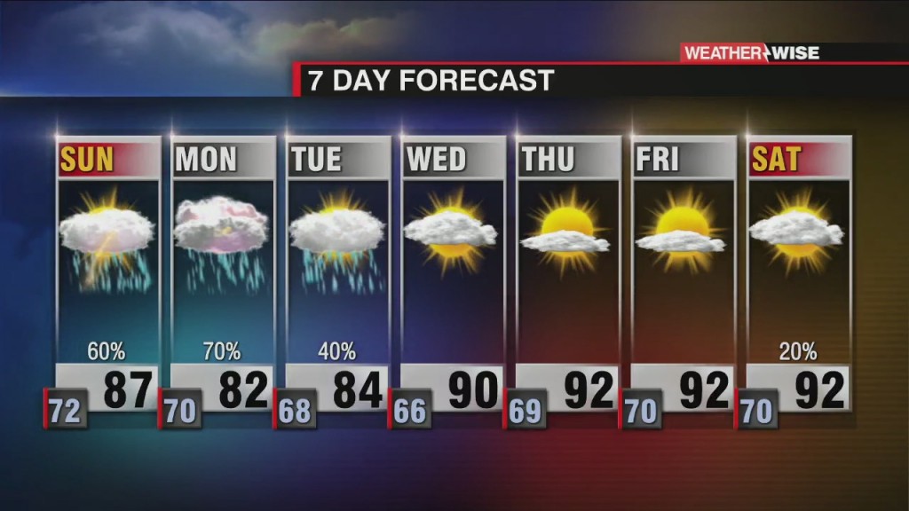
With Elsa in the rearview mirror, it's back to business as usual for the week ahead.
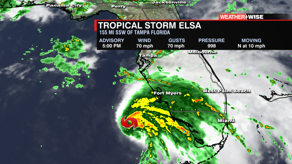
Elsa is expected to become a hurricane before landfall on Florida's west coast. Local impacts from Elsa will be begin late Wednesday into early Thursday.
Toasty temperatures and stifling humidity return to the forecast to start out the week before tropical trouble arrives.
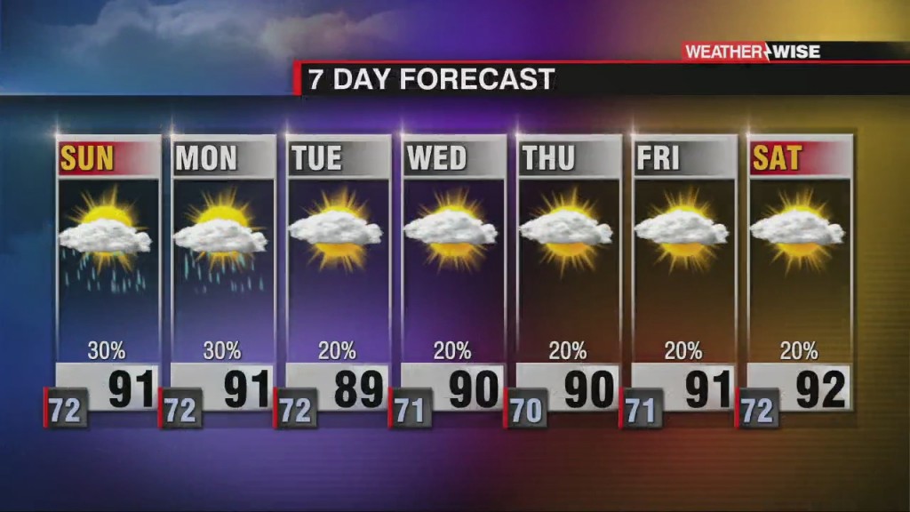
The beautiful weather continues through the holiday, but humidity and rain chances aren't far behind.
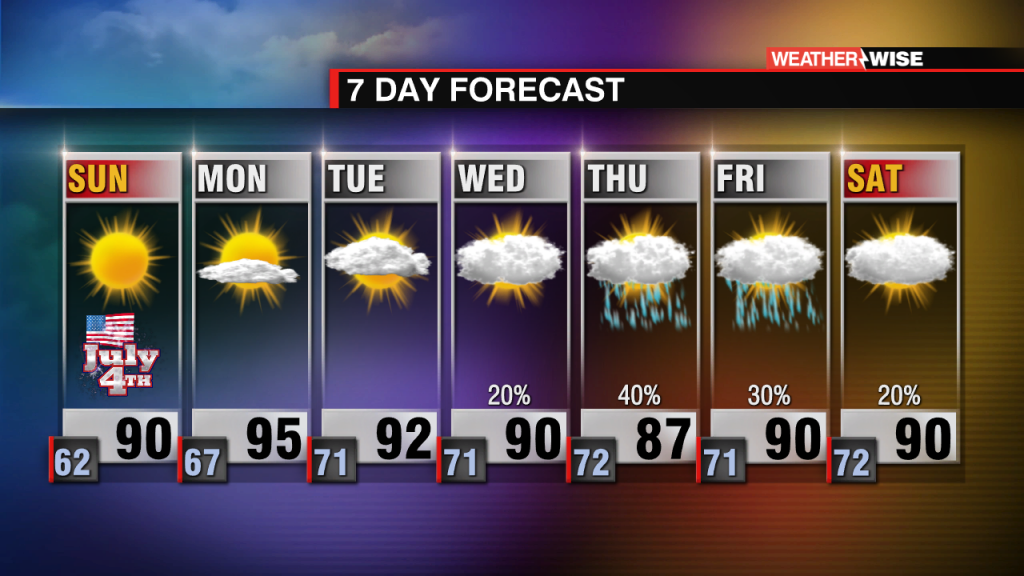
Expect sunshine and low humidity to last through July 4th, but don't get used to it.
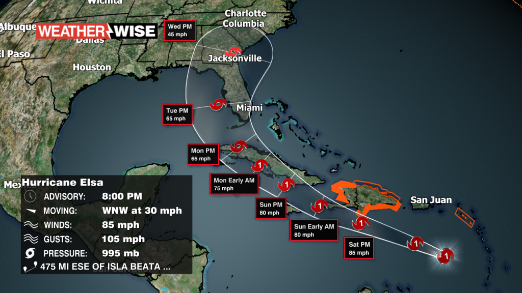
Hurricane Elsa continues racing through the Caribbean.
 Formerly Twitter