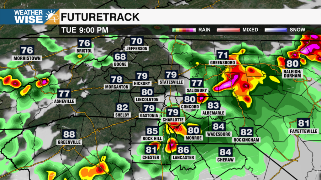
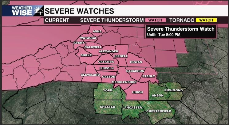
WCCB Weather

Latest Forecast

PREPARING FOR PROLONGED HEAT MOVING INTO THE REGION

We’re easing into Monday with a continuationΒ of what we saw over the weekend! Temperatures start off in the 50s early in the morning and climb into the low to mid-80s by the afternoon. The mountains expect a cooler start to the week with highs in the low 70s. After Monday, the pattern really begins to shift.

WCCB Weather Radar

Track storms live.

Current Conditions

Hourly Forecast

Extended Forecast

The First Hurricane Season Outlook Drops TodayΒ From ColoradoΒ State UniversityΒ 

One of the biggest storylines this year isn’t just in the Atlantic,Β it’s happening in the Pacific.Β There are growing signs that aΒ β€œSuper El NiΓ±o” could develop as we head into the peak of hurricane season. A typical El NiΓ±o means warmer-than-average water in the Pacific. AΒ SuperΒ El NiΓ±o takes that even further, with temperatures running aboutΒ 1.5 to 2Β°C above normal, which can have a stronger influence onΒ weather patterns.Β Right now, some of the latest guidance from NOAA and the ECMWF suggests there’s roughly aΒ 1-in-3 chanceΒ we could reach those levels by late summer or early fall.

Significant severe weather threat tonight through Monday

The severe weather threat is continuing to build across our region late tonight into Monday. The primary threats are damaging winds and even a few tornadoes, especially for locations south of I-85 and along and east of the I-77 corridor.

Severe Weather Preparedness Week: Flooding

We say it all the time: turn around, don’t drown. That’s for good reason - the #1 cause of avoidable death from severe weather in the Carolinas is drivers trying to make it through flooded roadways.

WCCB Weather Team

𝕏

X Wccbcharlotte Follow 370x70 Formerly Twitter