Triple Digit Feels And More Strong Storms
AM Headlines:
- Hot and Steamy
- Ring of Fire
- Afternoon Storms
- Weekend Cold Front
Discussion:
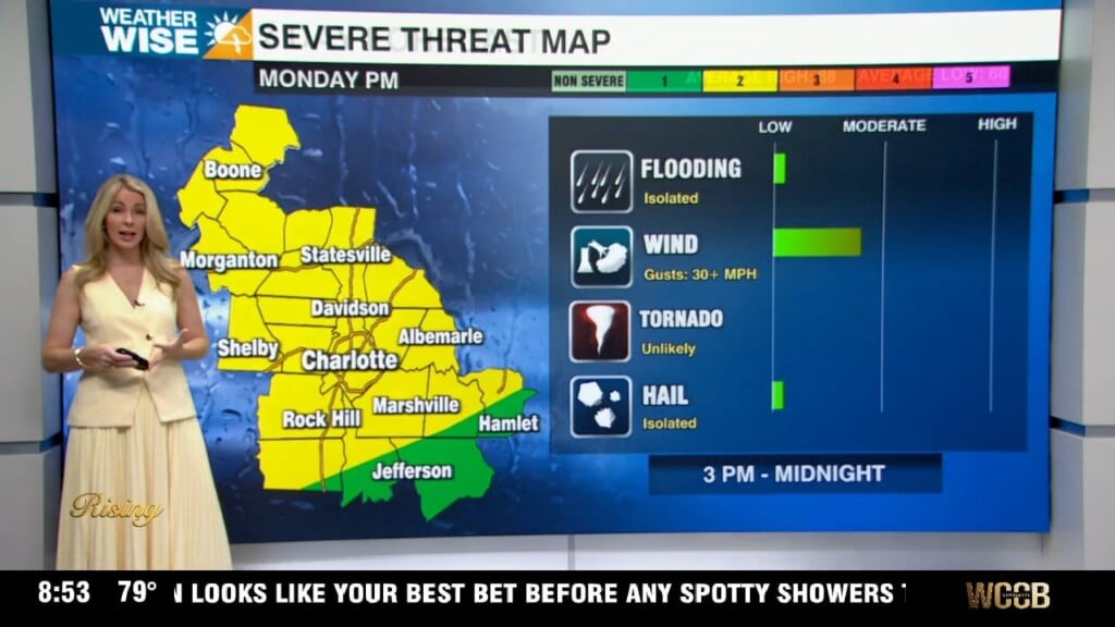
Prepare for a very hot and humid through the end of the week. Highs will reach the low 90s today, but with the humidity it will feel like 103-105. No advisories yet, but wouldn’t be surprised to see some added. High pressure is building in, and we’re going to be stuck in this ‘ring of fire’ pattern. Basically, we’re positioned between a trough to our east and a ridge to our west. This just means that this setup is directing warm and moist air into the region creating an ideal setup for storms and the development of MCS or clusters of storms that can travel long distances. Strong to severe storms with damaging wind and heavy downpours will be possible with most activity during the afternoon and evening. However, some storms could move in overnight into the early morning, although these usually aren’t as potent, but it will still be something to monitor. Temps will climb to the upper 90s, but it will feel like 105-110 Thursday and Friday. A cold front arrives Saturday, bringing the best chance of widespread rain and storms of the week. We’ll see a slight drop in temps, but expect above average highs in the low 90s through early next week.