Stalled Front Keeps Storm Chances In Play
AM Headlines:
- Daily Storm Chances
- Strong Storms Possible Tuesday
- Below Average Highs
- Heating Up this Weekend
Discussion:
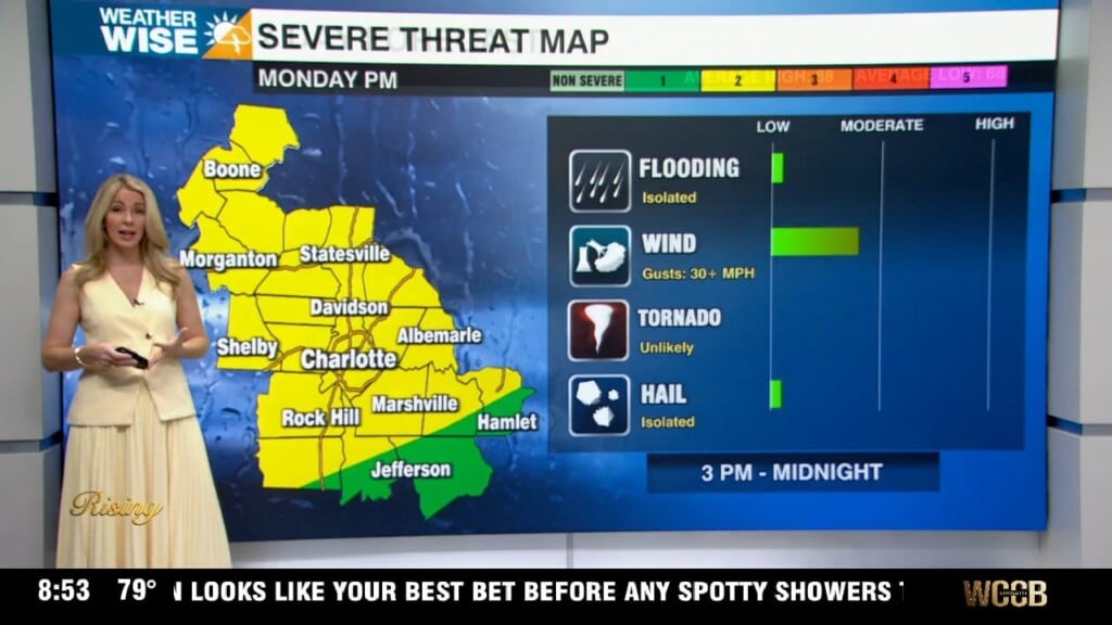
A stalled front will keep storm chances in the forecast this week. Storms this morning have produced heavy rain and led to a few flood advisories for rising creeks and streams across the region. Storms will taper off by mid-morning with a mix of sun and clouds for the afternoon. Highs will reach the mid to upper 80s with isolated storm chances. Stronger storms possible Tuesday as an upper level disturbance interacts with the stalled front. The biggest concern will be for damaging wind with any storms that become severe south and east of I-85. Temps will top out in the low to mid 80s Tuesday through Thursday, providing some relief from the summer heat. Temps will heat back up towards 90 this weekend. We will need to watch for an approaching cold front that could bring stronger storms to the region.
Tropics Update:
Potential Tropical Cyclone Five – High Chance of Development
PTC5 – Will likely become a tropical storm later today. The next name up would be Ernesto. It is located about 715 miles ESE of Antigua. It is expected to move across the Leeward Islands Tuesday and near the British and US Virgin Islands Tuesday night. It will likely curve toward the north by mid-week where it will have warm open waters to quickly strengthen into a major hurricane, passing east of Bermuda this weekend.