Dangerous Heat Builds Into Weekend
Rain chances remain isolated-at-best until Saturday evening.
If you’ve thought it’s been hot recently, get ready for Mother Nature to crank the thermostat even higher into the weekend. While the six-day 90º streak at CLT may not continue into Thursday, due to clouds and storms over the airport, it is all but likely to pick up where it left off by the weekend. In fact, the American model is putting up triple-digit numbers for Sunday afternoon – and that doesn’t even factor in the humidity. The hot trend will likely continue into next week, as well.
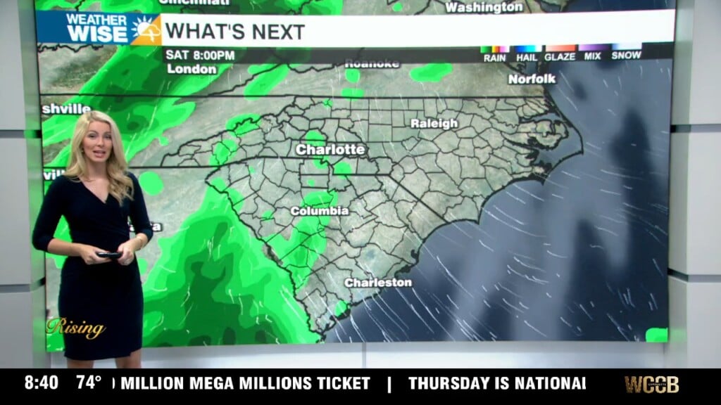
In terms of rain chances, isolated pop-up storms will be the main event through Saturday afternoon. As we move into Saturday evening, however, a weak trough will move through and bump rain chances into the “scattered” range. Outside of Saturday night, it will be a crapshoot to see rain across the viewing area, and most of us will remain dry for the majority of the days ahead.
Tonight: Sticky. Low: 74°. Wind: SE 5-10.
Friday: Mostly sunny. PM pop-up storms. High: 94°. Wind: SW 5-10.
Friday Night: Storm chance early, then mostly clear. Low: 74°. Wind: Light.
Saturday: Variable clouds. Scattered storms late. High: 94°. Wind: SW 5-10.