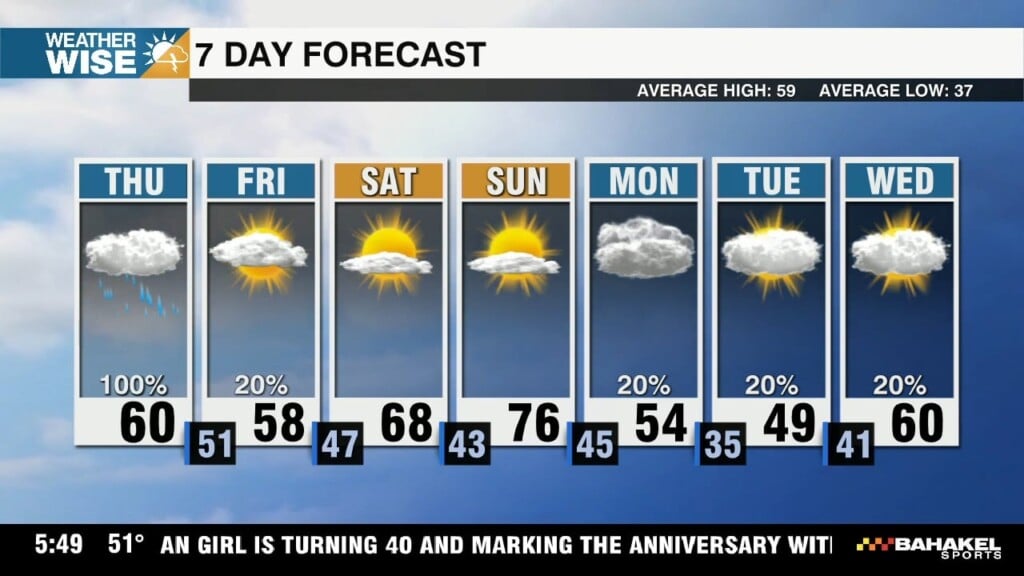
Soggy Thursday, warm & sunny weekend ahead
Most locations in the WCCB Charlotte viewing area receive at least a half-inch of much-needed rain through Thursday evening.

Most locations in the WCCB Charlotte viewing area receive at least a half-inch of much-needed rain through Thursday evening.
Our best chance for rain arrives on Thursday, but a few showers may linger around our southeastern counties through the start of the weekend.
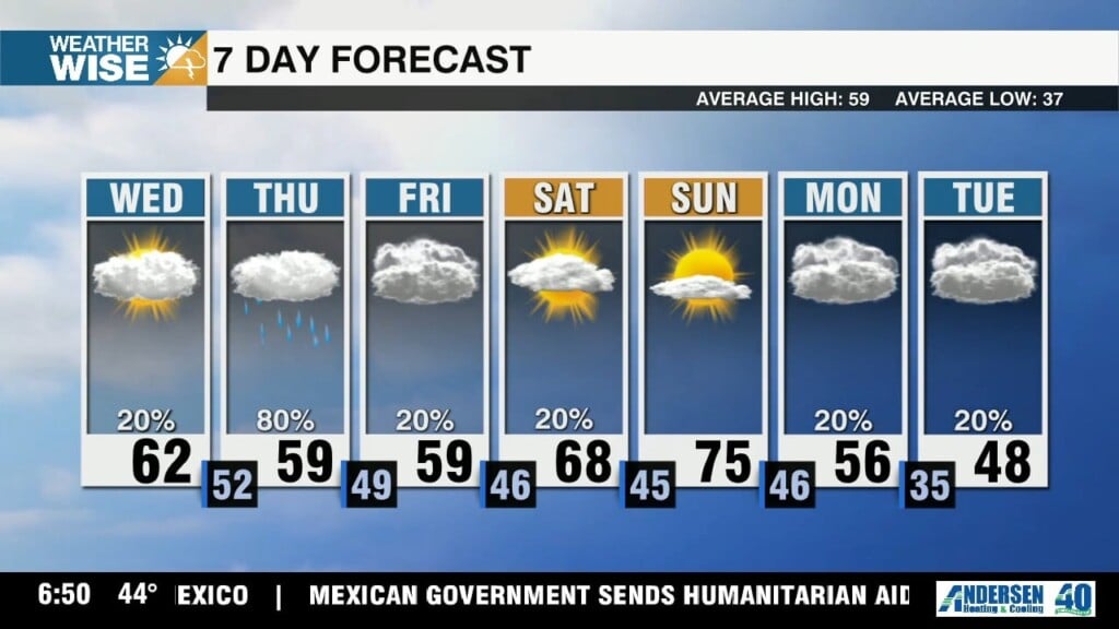
Highs will once again struggle to clear the 30s & 40s this Tuesday afternoon, but the mercury surges closer to 60° in the Queen City on Wednesday.
The coldest air we've seen in over two weeks arrives to kick off the workweek, but temperatures recover nicely by the weekend.
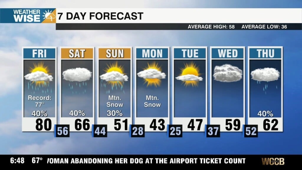
Highs may crack 80° in portions of the WCCB Charlotte viewing area for the first time in three months, but don't expect winter to go down without a fight.
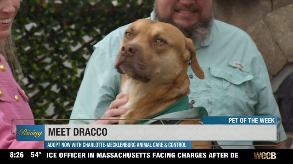
A two-year-old lab mix, Dracco is a stunning mixed breed with the softest golden fawn colored fur and beautiful amber eyes. He is a gentle and loving boy who wants to be with and please his humans. He is motivated to learn and enjoys toys, scratches, and treats.
Highs soar near 80° to wrap up the workweek, as sporadic shower and storm activity lingers through the weekend.
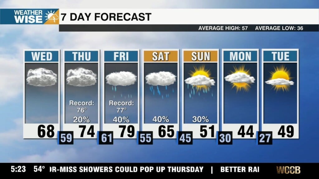
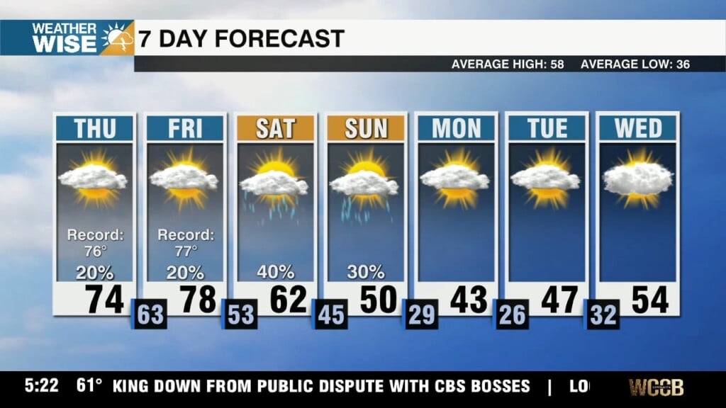
Highs approach record territory by the end of the week despite building cloud cover and rain chances.
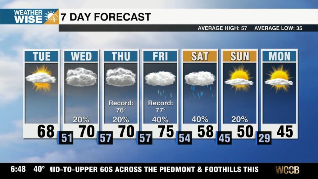
Temperatures may approach record high territory in the Queen City by the end of the week.
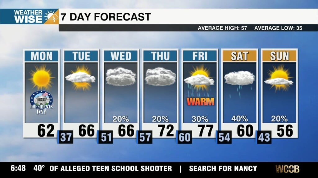
Highs top out near 60° for most around the Metro this Presidents' Day Monday, but the warmest air we've seen so far this year is just around the corner.
 Formerly Twitter