Tuesday’s Cold Front Bringing a Marginal Risk
Tuesday's cold front will bring scattered showers with an isolated severe storm threat.


Tuesday's cold front will bring scattered showers with an isolated severe storm threat.
Threat for flash flooding from what will likely become Tropical Storm Claudette will stretch into the southeast this weekend.
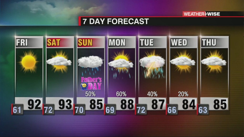
Increasing temperatures and humidity dominate Friday and Saturday ahead of tropical moisture.
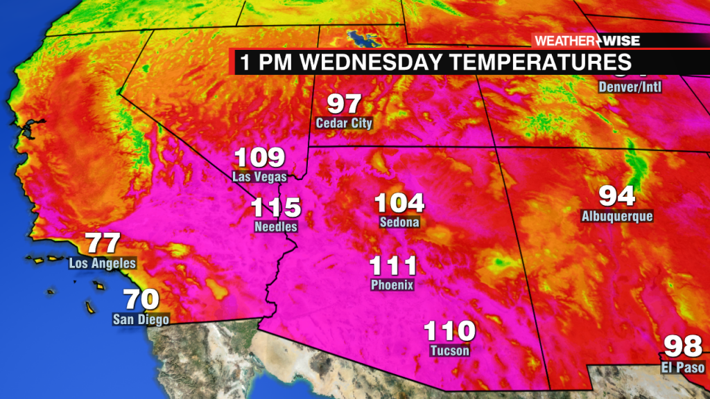
Furnace creek holds the record for the hottest recorded temperature on Earth which was 134°. They will make a run at 130° this week.

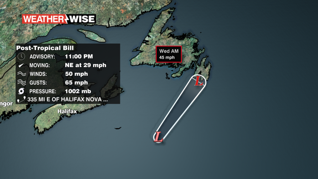
So long, Bill! Bill is now Extratropical. No further advisories will be issued.

Sunshine and lower humidity in control through Thursday
Lower humidity dominates midweek, but it is short-lived so enjoy it!

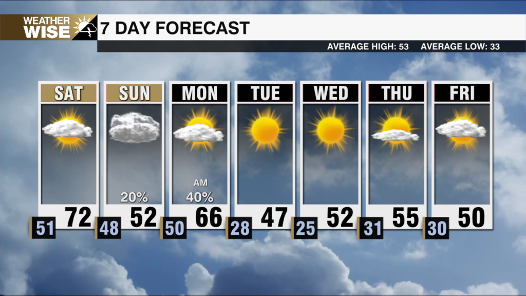
Temperatures and humidity falling in wake of Monday evening cold front
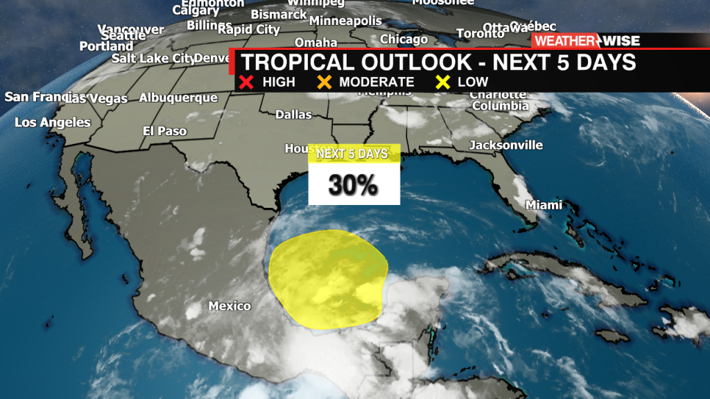
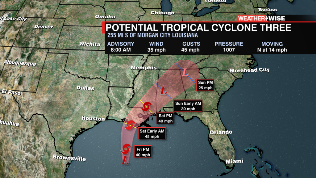
Eyes on the Bay of Campeche for potential tropical development.
 Formerly Twitter