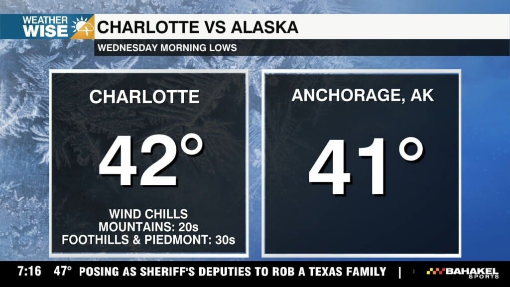
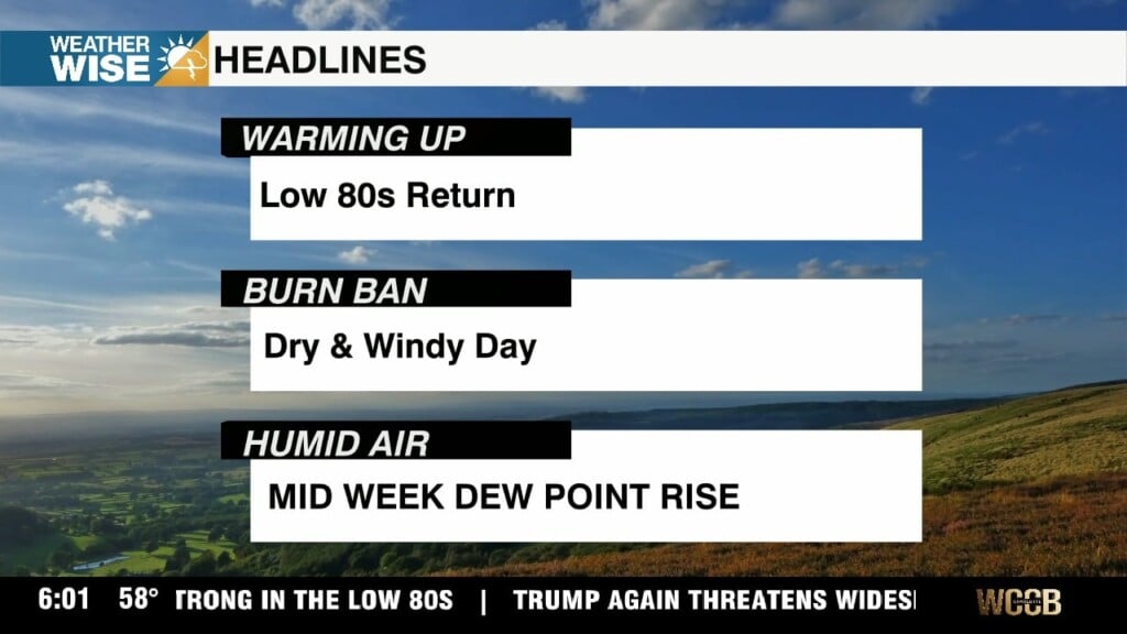
Below average temperatures Wednesday
Humidity levels are expected to fall into the 25–30% range, and when combined with wind gusts exceeding 20 mph, the risk for fire spread has increased.

Humidity levels are expected to fall into the 25–30% range, and when combined with wind gusts exceeding 20 mph, the risk for fire spread has increased.
Afternoon highs will stay on the cooler side, generally in the upper 60s to low 70s, with noticeably lower humidity.
Cooler, drier air settles in bringing noticeable temperature changes Monday. Lower humidity will make it feel crisp and comfortable each afternoon through Wednesday.

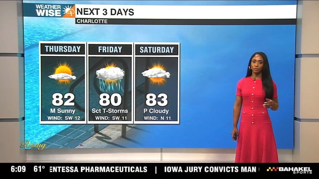
Good Friday morning! It’s a warm and slightly more humid start to the day, and that trend will stick with us through the afternoon. Expect highs to climb into the low to mid 80s, with a mix of sun and clouds throughout the day.
The unsettled weather pattern sticks around into Thursday and Friday, but the big story is the warmth it will continue to feel more like early summer than early spring.
As we move into the afternoon, things turn a bit more active. After about 3 p.m., we’ll be watching for a few showers and thunderstorms to develop. It’s not going to be a washout, but some neighborhoods could see rain especially right around the evening commute.
We really start to crank up the heat on Tuesday and Wednesday. Tuesday looks like one of those days you just want to be outside with lots of sunshine with highs around 81°. It will be a little breezy though, with gusts up to 20 or even 25 mph, so just keep that in mind if you’ve got anything loose outside.
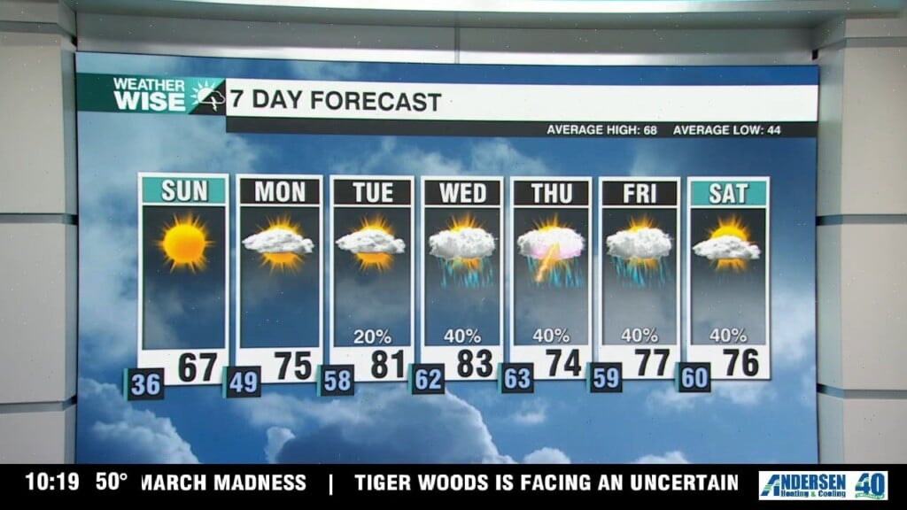
Heading into Monday, you’ll start to feel that warm-up settle in. It won’t be a perfect blue-sky day, but we’ll get a nice mix of sun and clouds, and temperatures will climb to the mid 70s.

We are in for a big warm-up, with temperatures soaring into the upper 80s to 90 degrees by this afternoon. That’s not just warm it’s record-challenging heat. The current record for the day is 85 degrees, set back in 1950, and we’re expected to beat it.
All eyes are on Friday, when temperatures surge even higher approaching 90 degrees in many spots. That puts us in position to break a long-standing record of 85 degrees, set back in 1950. So yes, we’re not just talking about a warm stretch we’re talking about record-breaking heat to wrap up the workweek.
 Formerly Twitter