Cold start with the 70s by mid afternoon
Trending warmer Wednesday
A Freeze Warning is in place for Ashe, Watauga and Avery counties, with a Frost Advisory for sections of the Piedmont until 9am.
After that chilly start, things flip pretty quickly. Sunshine will take over with highs back in the 70s
By the middle of the week, high pressure builds back in and winds shift out of the southwest. That’s going to bring a big warm-up, with afternoon highs climbing back into the mid to upper 80s through the end of the week.
Winds won’t be quite as strong as yesterday, the combination of warmth and dry conditions means fire danger will stay elevated.
Rain chances are starting to creep back into the forecast for the Southeast. It’s not a slam dunk yet, but the trend is moving in the right direction with at least some shower potential returning this weekend..
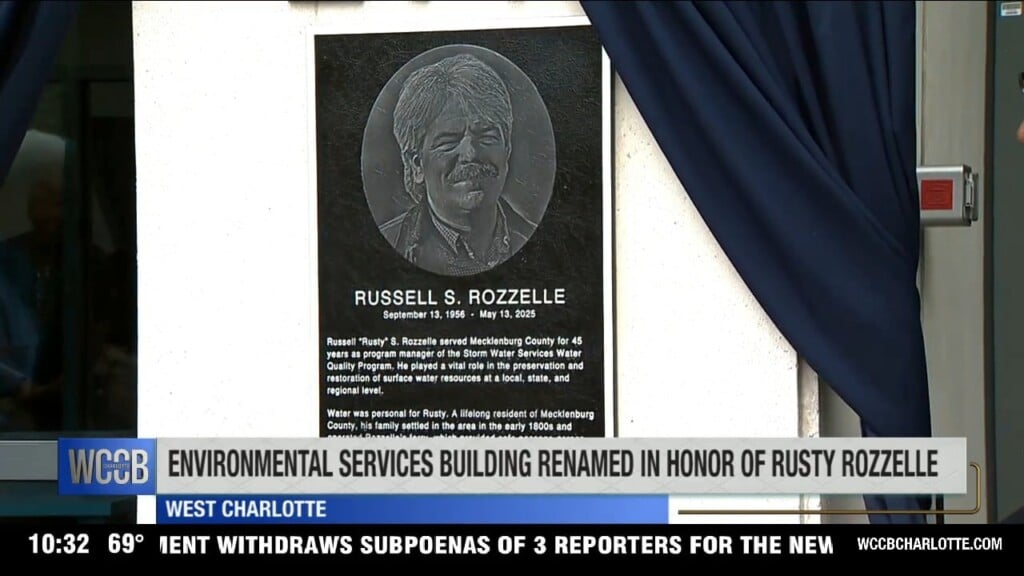
Click here for more news from WCCB Charlotte.