Below average temperatures Wednesday
Humidity levels are expected to fall into the 25–30% range, and when combined with wind gusts exceeding 20 mph, the risk for fire spread has increased.
Sections
WCCB
Extras

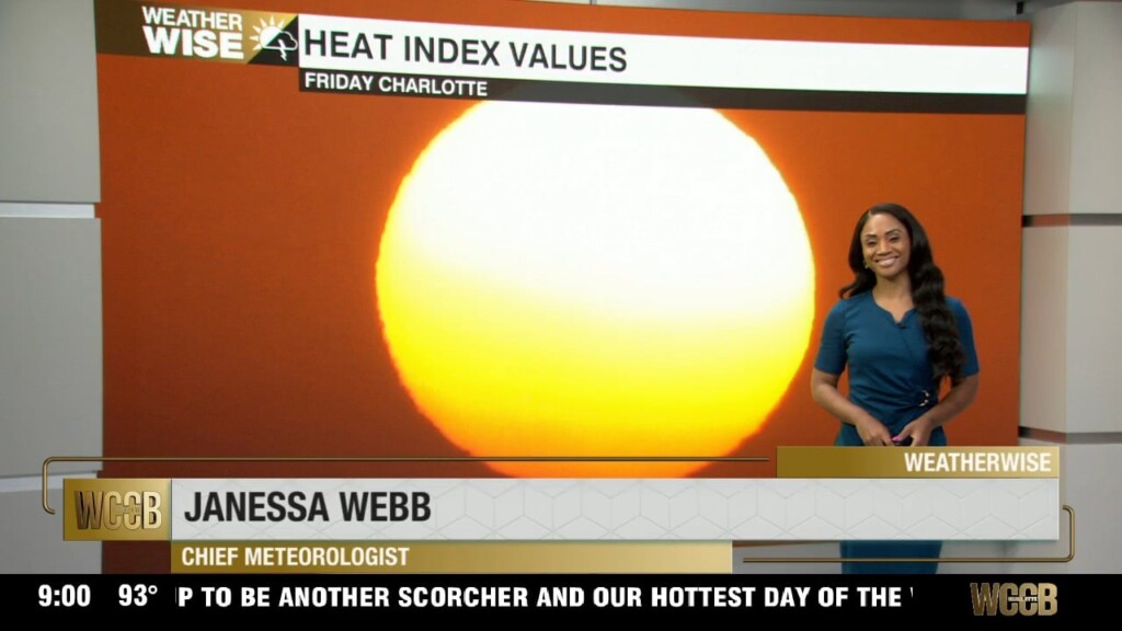
Nationally recognized Meteorologist Janessa Webb brings her passion for weather and storytelling to the WCCB Charlotte WeatherWise team, where she delivers accurate and engaging forecasts every weekday evening at 9 and 10 p.m.
Born and raised in Anchorage, Alaska, Janessa’s passion for extreme weather began at an early age and has guided her through an extensive career in both national and local television. She returned to North Carolina after nearly four years in Washington, D.C., where she built a weather department from the ground up and served as Chief Meteorologist for several leading broadcasts.
Before that, Janessa was a Meteorologist for NBC News and MSNBC in New York City, appearing on programs such as Early Today, Morning Joe, NBC Nightly News, and The 11th Hour with Brian Williams. She also filled in for Al Roker on TODAY and previously served as a weekday meteorologist for WEWS-TV in Cleveland, Ohio. Webb spent her early years as a meteorologist in Anchorage, Alaska, at KYUR and KTVA for nearly nine years. She graduated from East Anchorage High School prior to studying at Winston-Salem State University and Mississippi State University.
Webb is a member of the National Weather Association, The American Meteorological Society, the National Association of Black Journalists. Webb has served as a mentor to young journalists throughout her career and believes strongly in giving back to the community.
When Webb isn’t tracking the weather, her faith and family remain the center of her life and foundation. She also has a passion for teaching and is a certified hot yoga instructor and personal trainer, she embraces an active lifestyle and loves a good adventure.
Humidity levels are expected to fall into the 25–30% range, and when combined with wind gusts exceeding 20 mph, the risk for fire spread has increased.
Afternoon highs will stay on the cooler side, generally in the upper 60s to low 70s, with noticeably lower humidity.
Cooler, drier air settles in bringing noticeable temperature changes Monday. Lower humidity will make it feel crisp and comfortable each afternoon through Wednesday.
Good Friday morning! It’s a warm and slightly more humid start to the day, and that trend will stick with us through the afternoon. Expect highs to climb into the low to mid 80s, with a mix of sun and clouds throughout the day.
The unsettled weather pattern sticks around into Thursday and Friday, but the big story is the warmth it will continue to feel more like early summer than early spring.
As we move into the afternoon, things turn a bit more active. After about 3 p.m., we’ll be watching for a few showers and thunderstorms to develop. It’s not going to be a washout, but some neighborhoods could see rain especially right around the evening commute.
We really start to crank up the heat on Tuesday and Wednesday. Tuesday looks like one of those days you just want to be outside with lots of sunshine with highs around 81°. It will be a little breezy though, with gusts up to 20 or even 25 mph, so just keep that in mind if you’ve got anything loose outside.
Heading into Monday, you’ll start to feel that warm-up settle in. It won’t be a perfect blue-sky day, but we’ll get a nice mix of sun and clouds, and temperatures will climb to the mid 70s.
We are in for a big warm-up, with temperatures soaring into the upper 80s to 90 degrees by this afternoon. That’s not just warm it’s record-challenging heat. The current record for the day is 85 degrees, set back in 1950, and we’re expected to beat it.
All eyes are on Friday, when temperatures surge even higher approaching 90 degrees in many spots. That puts us in position to break a long-standing record of 85 degrees, set back in 1950. So yes, we’re not just talking about a warm stretch we’re talking about record-breaking heat to wrap up the workweek.
icons go here