
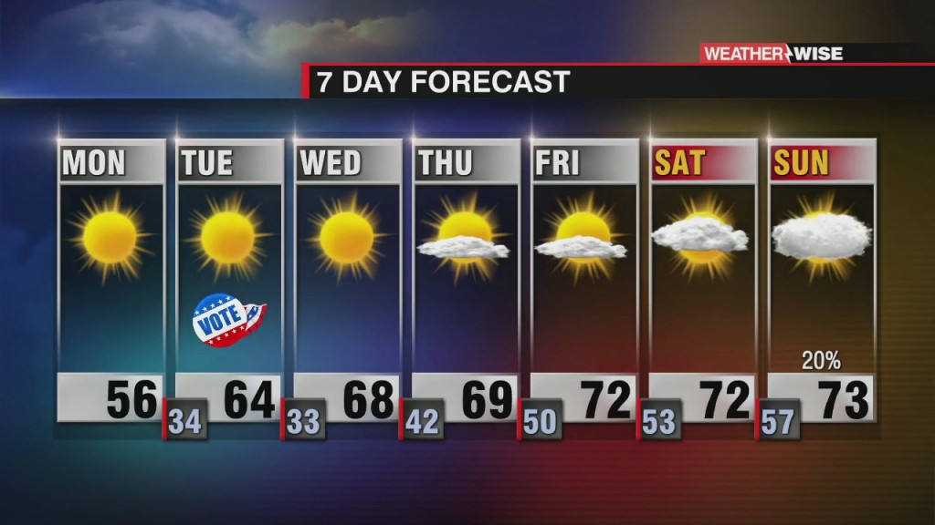
Gradual Warming Through the Week
A beautiful week ahead with gradual warming and plenty of sunshine.

A beautiful week ahead with gradual warming and plenty of sunshine.
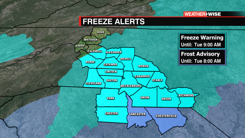
Temperatures will drop at or below freezing early Tuesday morning so be sure you cover your plants and bring the pets in. The Mountains will see low temperatures in the 20s with the Piedmont flirting with freezing. Frost Advisory…
Another cold night ahead with Frost Advisories and Freeze Warnings in effect.

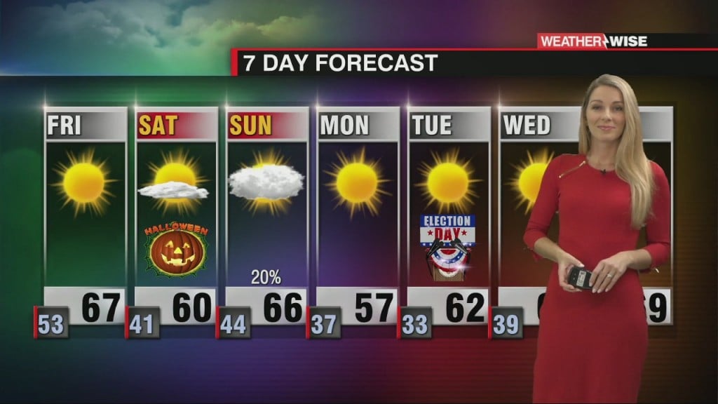
A beautiful end to the week with cool, dry air in place. Another cold front rolls through Sunday with isolated showers possible ahead of reinforcing cold air.

In typical 2020 fashion, the second full moon of the month is on Halloween!
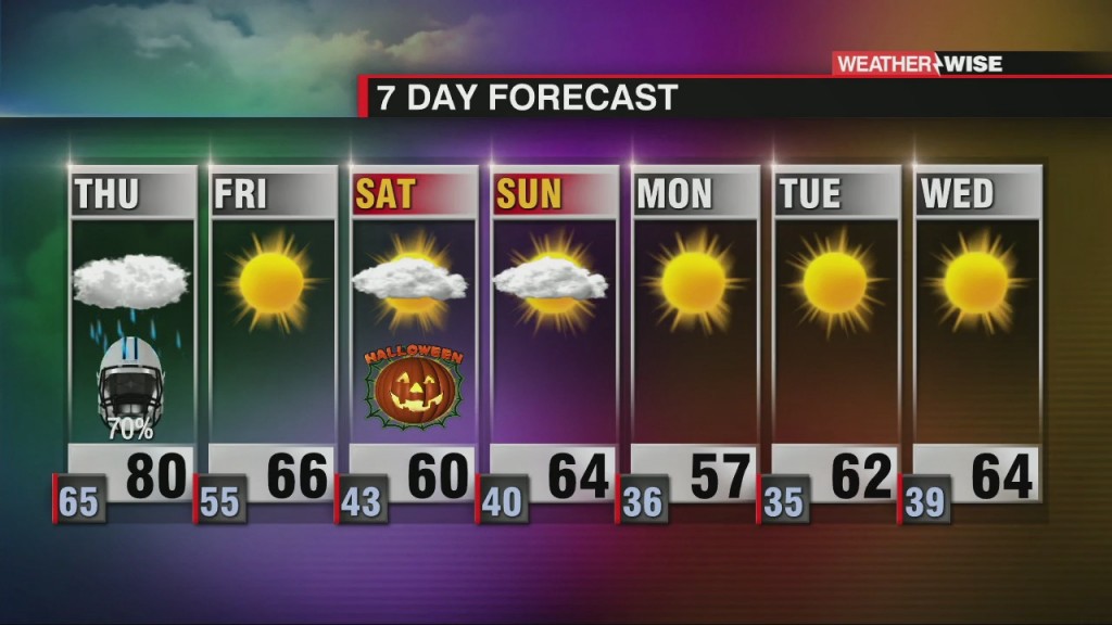
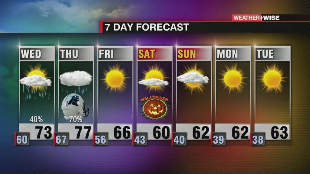
Another round of scattered showers, gusty winds and isolated storms before a big cool down!
Zeta will soon race toward the Carolinas and bring strong wind, rain and the potential for isolated strong storms.

Latest track and potential local impacts from Zeta.
Increasing showers tomorrow ahead of the merging of Zeta and a cold front.

Details on running out of letters and the Greek alphabet names being retired.
 Formerly Twitter