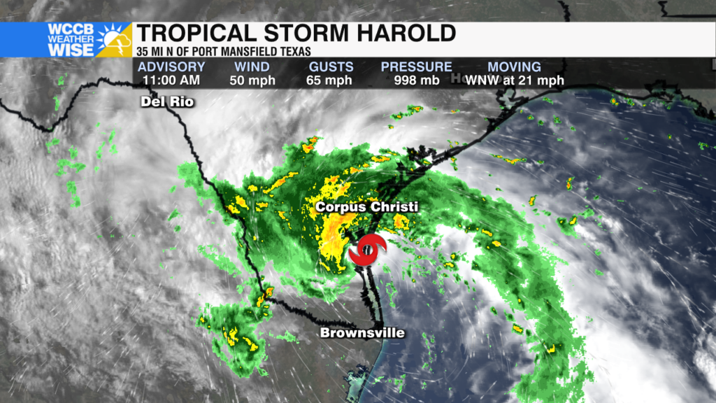
Tropical Storm Harold Makes Landfall in Texas
The storm made landfall on Padre Island, TX just after 10am CDT with sustained winds of 50mph.
Sections
WCCB
Extras
Nicole Madden is the WCCB’s Chief Meteorologist, providing the morning forecasts on News Rising on WCCB Charlotteβs CW. Nicole joined the WCCB Charlotte weather team in August 2017.
She comes to us from KSLA in Shreveport, LA where she was the Weekday News Now at 4pm Meteorologist.
Nicole spent the first three years forecasting for the ArkLaTex. From tornado outbreaks in Dixie Alley to the Red River Flood of 2015 and again in 2016 to wildfires, flash flooding from Tropical Storm Bill and yes, even winter weather – she has experienced nearly everything Mother Nature has to offer. Not only was Nicole forecasting in the studio, but she took her expertise into the elements to track storms and cover the aftermath of the not so nice side of Mother Nature.
She also loves to get out into the community and do personal event forecasts from different towns in each and every county in the viewing area.
Nicole graduated from Florida State University in 2014 with a Bachelorβs of Science in Meteorology and a minor in Mathematics. She is an active member of the American Meteorological Society. Prior to her degree at FSU, she graduated from the University of Pittsburgh with her Bachelorβs of Science and a dual degree of Business and Communication.
When Nicole doesnβt have her head in the clouds she loves playing with her rescue pup, Colby, traveling and watching the βNoles and New York Jets during football season.
The storm made landfall on Padre Island, TX just after 10am CDT with sustained winds of 50mph.
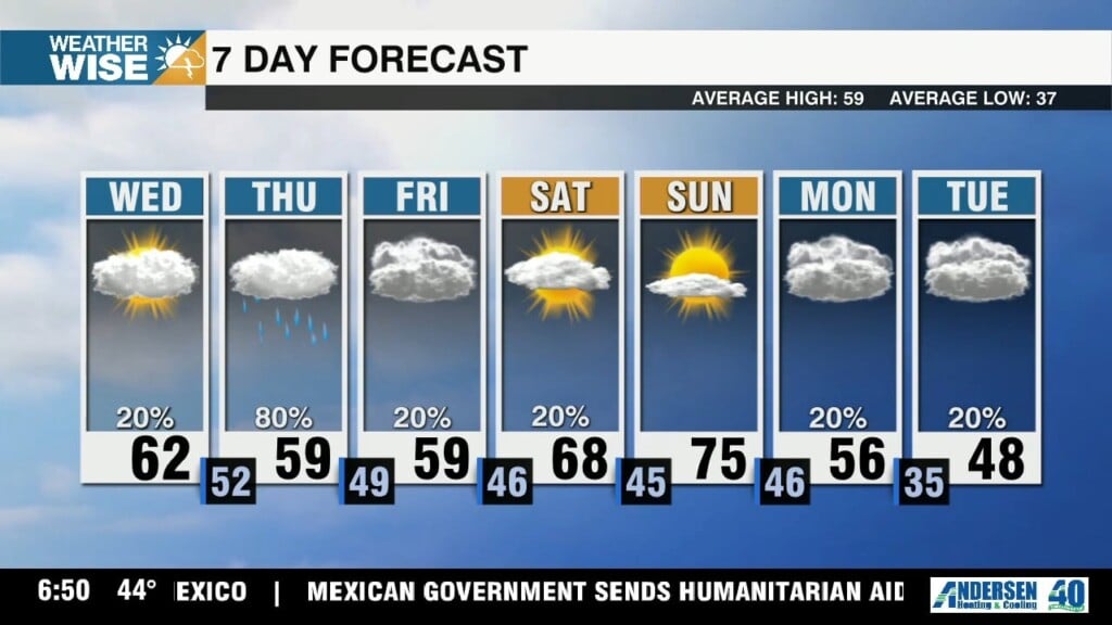
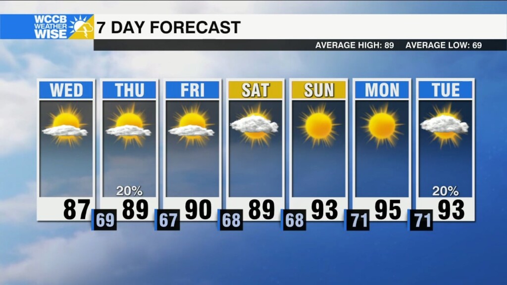
Hot and dry forecast continues today. Cold front will move in overnight, dropping temps near normal Wednesday.
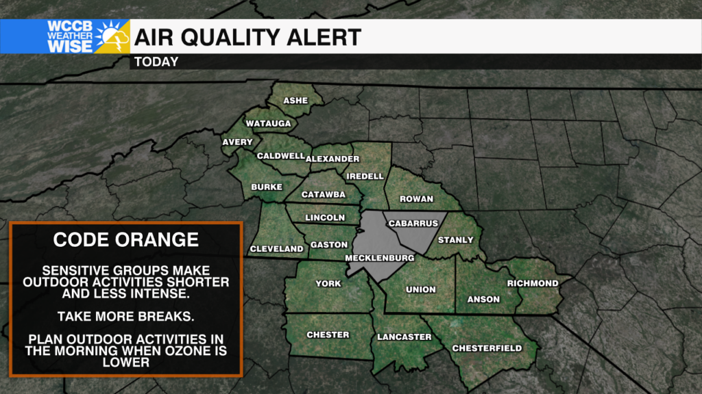
A Code Orange Air Quality Alert is in effect for Mecklenburg and Cabarrus Counties until 8pm Monday
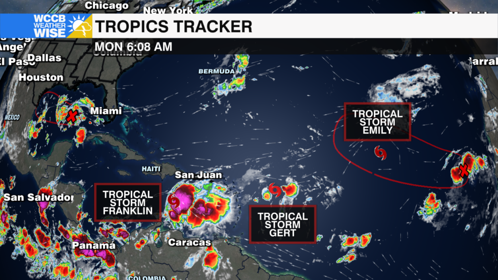
There are now three tropical storms in the Atlantic with two other areas being watched for potential development this week.
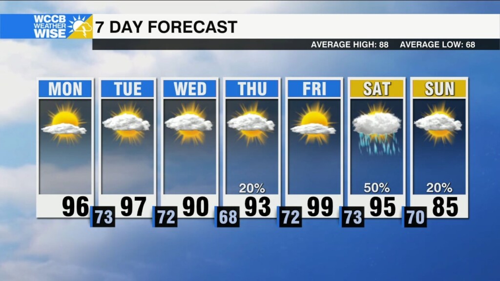
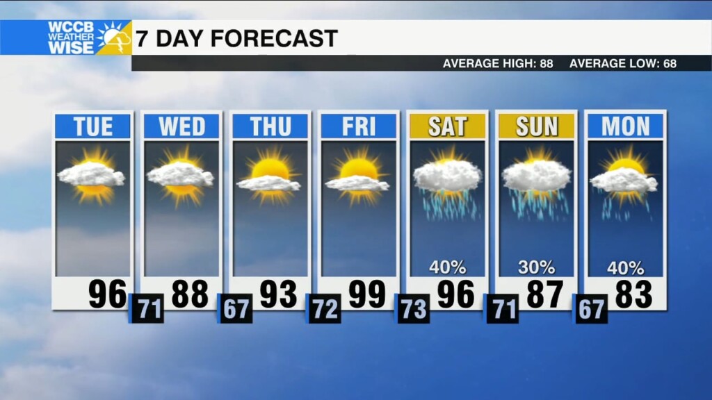
Heating up this week as a ridge of high pressure builds. Minimal rain chances w/ a brief cool down Wednesday.
Today, a cold front will cross through the region, reinforcing drier and slightly cooler air. Temps will be heating up next week.
Quiet pattern continues, just isolated rain/storm chances today.
Slightly cooler with a big drop in humidity today.
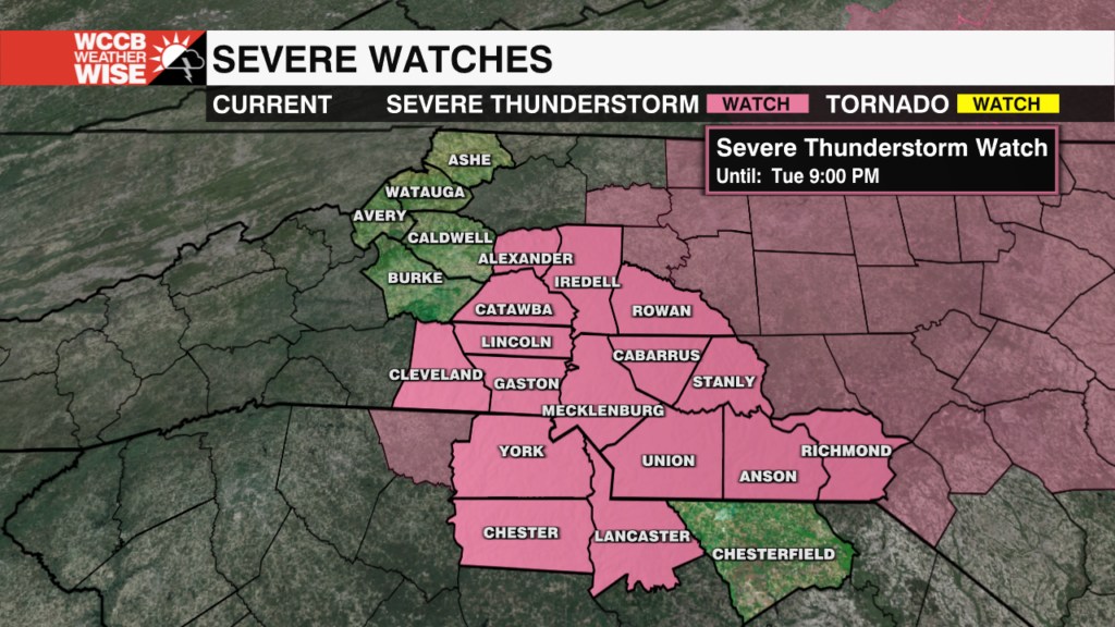
A Severe Thunderstorm Watch has been issued for most of the Piedmont through 9pm.
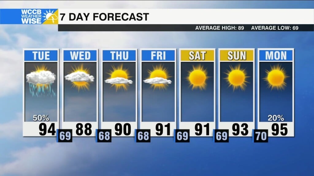
Heat advisory is in effect again today. Afternoon strong to severe storms are possible.
icons go here