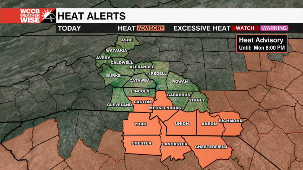
Heat Advisory in Effect for Parts of the Region Monday
A heat advisory is in effect until 8pm as heat indices soar near 105 Monday afternoon.
Sections
WCCB
Extras
Nicole Madden is the WCCB’s Chief Meteorologist, providing the morning forecasts on News Rising on WCCB Charlotteβs CW. Nicole joined the WCCB Charlotte weather team in August 2017.
She comes to us from KSLA in Shreveport, LA where she was the Weekday News Now at 4pm Meteorologist.
Nicole spent the first three years forecasting for the ArkLaTex. From tornado outbreaks in Dixie Alley to the Red River Flood of 2015 and again in 2016 to wildfires, flash flooding from Tropical Storm Bill and yes, even winter weather – she has experienced nearly everything Mother Nature has to offer. Not only was Nicole forecasting in the studio, but she took her expertise into the elements to track storms and cover the aftermath of the not so nice side of Mother Nature.
She also loves to get out into the community and do personal event forecasts from different towns in each and every county in the viewing area.
Nicole graduated from Florida State University in 2014 with a Bachelorβs of Science in Meteorology and a minor in Mathematics. She is an active member of the American Meteorological Society. Prior to her degree at FSU, she graduated from the University of Pittsburgh with her Bachelorβs of Science and a dual degree of Business and Communication.
When Nicole doesnβt have her head in the clouds she loves playing with her rescue pup, Colby, traveling and watching the βNoles and New York Jets during football season.
A heat advisory is in effect until 8pm as heat indices soar near 105 Monday afternoon.
Heat Advisory in effectΒ for much of the region today as heat indices climb to near 105.
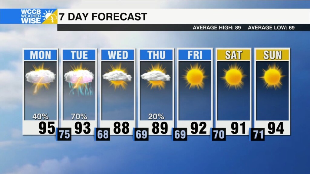
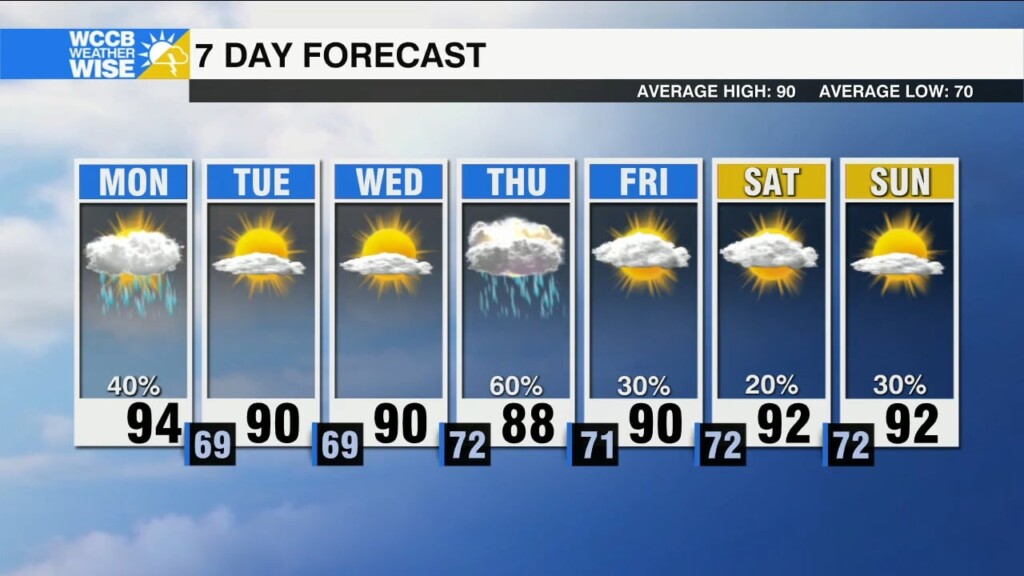
Scattered storms today. Heating up this weekend with feels like tempsΒ reaching 105.
Confidence is increasing that the Atlantic Basin will be more active than normal as we near peak hurricane season.
Threat of severe weather arrives in time for the AM Commute. Widespread rain with storms capableΒ of producing heavy downpours and localized flooding. Potential for isolatedΒ severe storms late this afternoon.
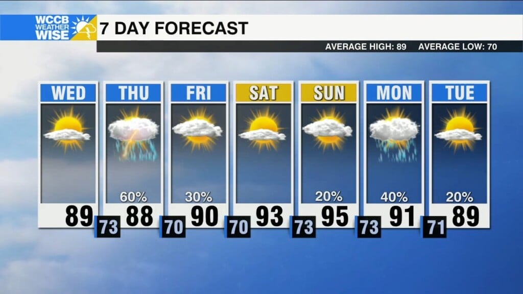
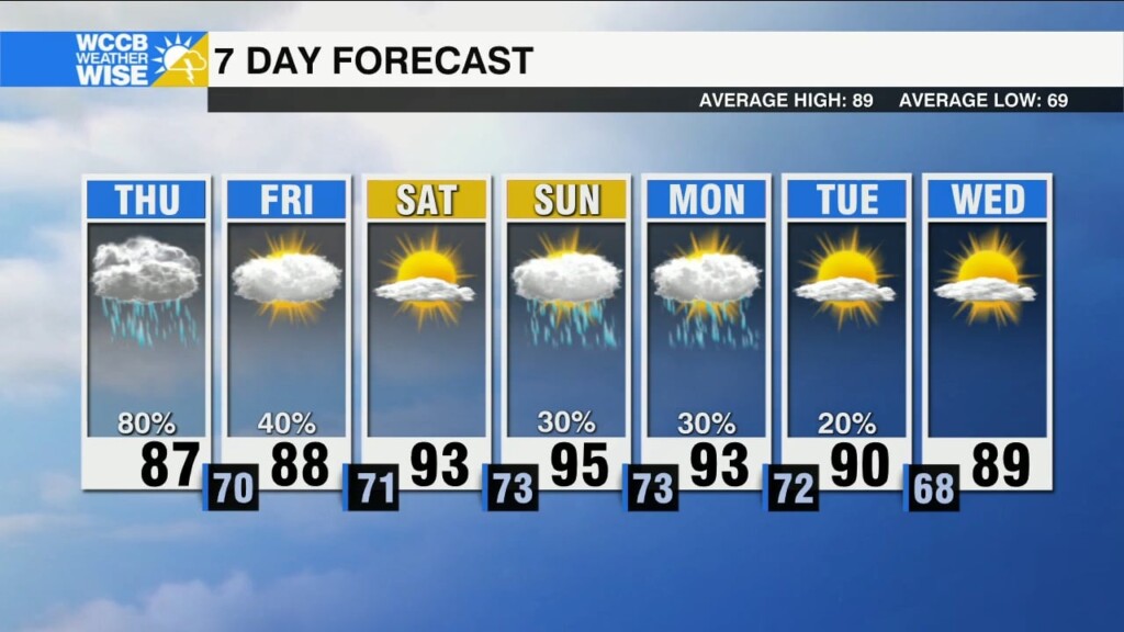
Sunny and warm today. Potential for strong to severe storms Thursday.
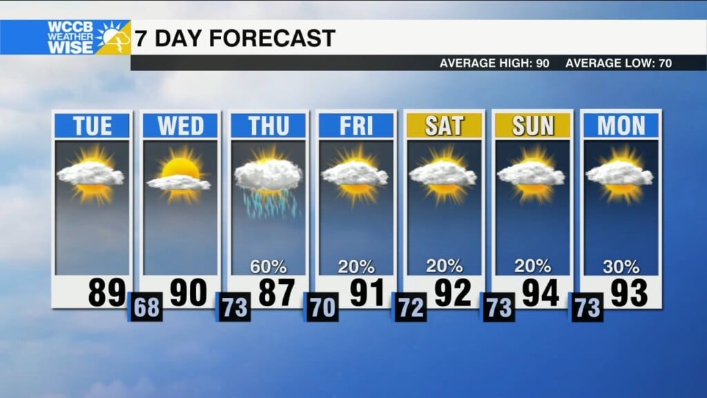
Drier air takes hold through Wednesday. Strong storms possible once again Thursday.
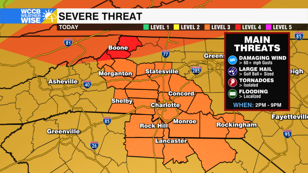
It is the first time since April 2011 that parts of the high country have been under a level 4 (out of 5) severe threat. Widespread wind damage, large hail, isolated tornadoes and localized flooding are all concerns.
A severe threat in the forecastΒ today with damaging wind, largeΒ hail, and isolated tornadoes possible.
Rounds of rain and storms could lead to a localized flooding threat through the end of the week.
icons go here