Heat Safety Tips As Summer Nears
Extreme heat and humidity is one of the leading weather-related killers in the United States. Be sure you know how to protect yourselves and your animals.
Extreme heat and humidity is one of the leading weather-related killers in the United States. Be sure you know how to protect yourselves and your animals.

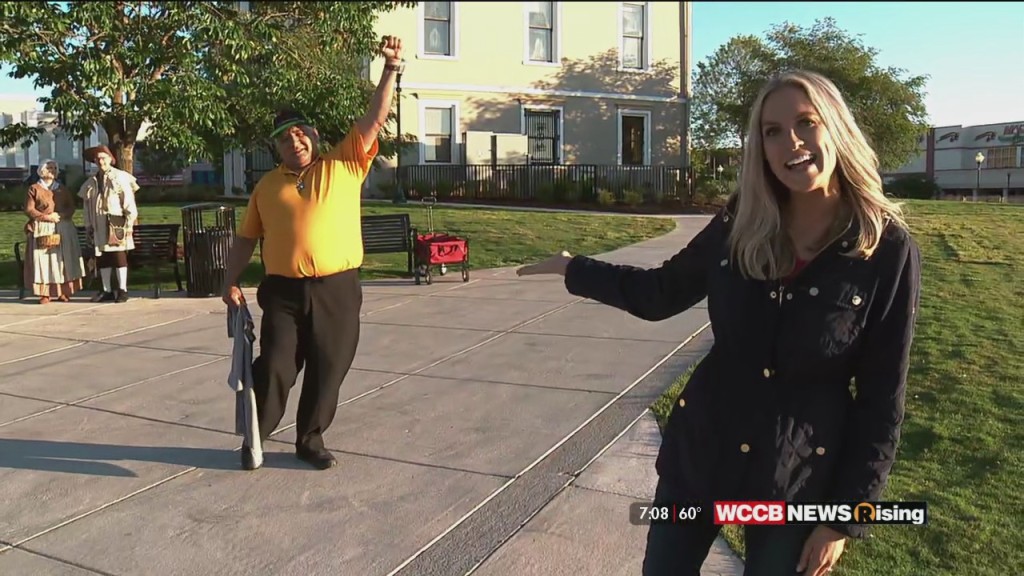
The Bright Spot made moves to Salisbury to preview the Cheerwine Festival, celebrating 105 years of Carolina's favorite soft drink.
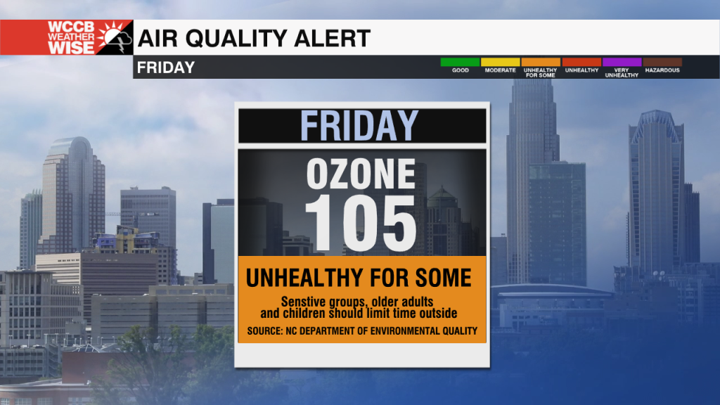
Due to high levels of ground-level ozone an Air Quality Alert is in effect for a portion of the region on Friday.
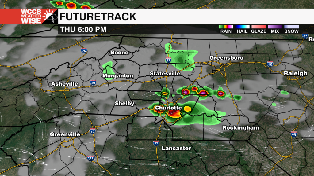
Most of Thursday will be hot and sunny, but isolated severe storms are possible.
Hurricane season is just a few weeks away. Now is the time to check your flood risk.
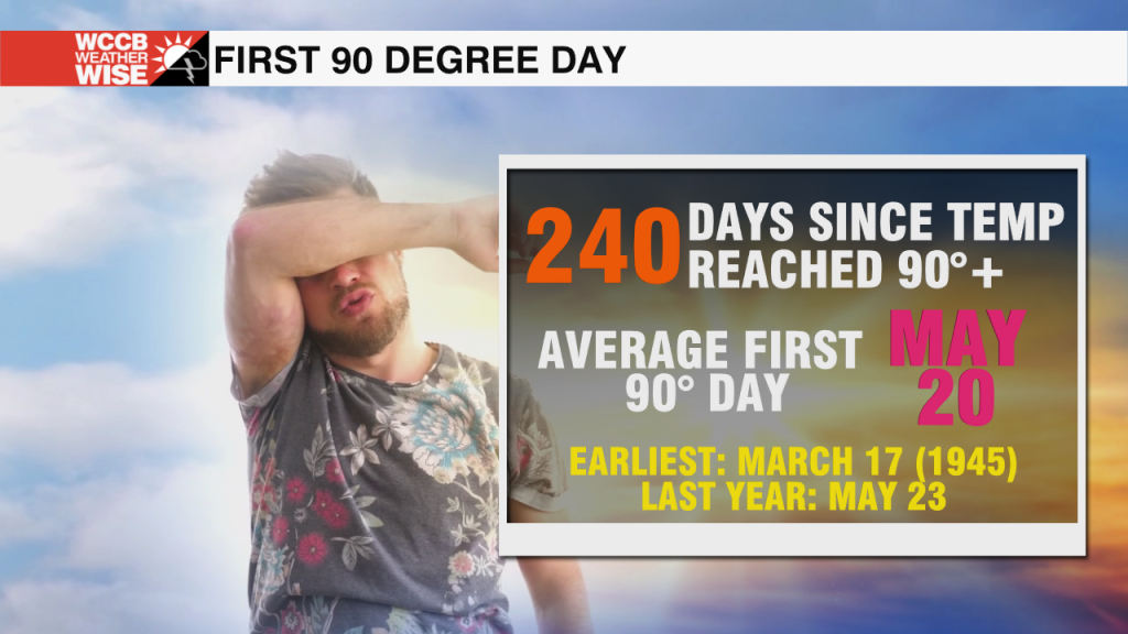
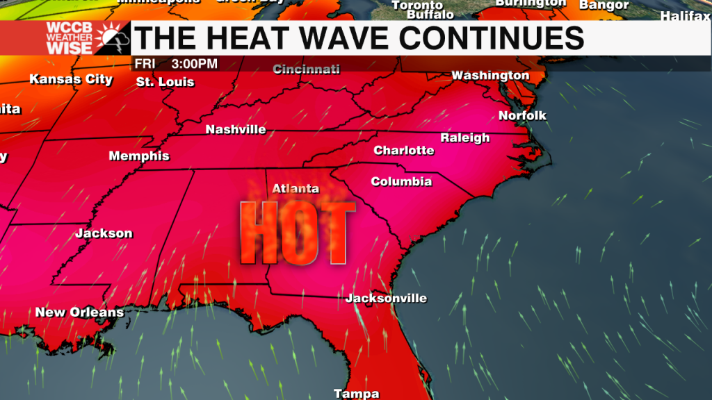
A stretch of 90 degree days will be the first of the 2022 season.
This week's Bright Spot takes us to the Hollywood (Foot)Hills to celebrate Morganton's role in cinematic history.
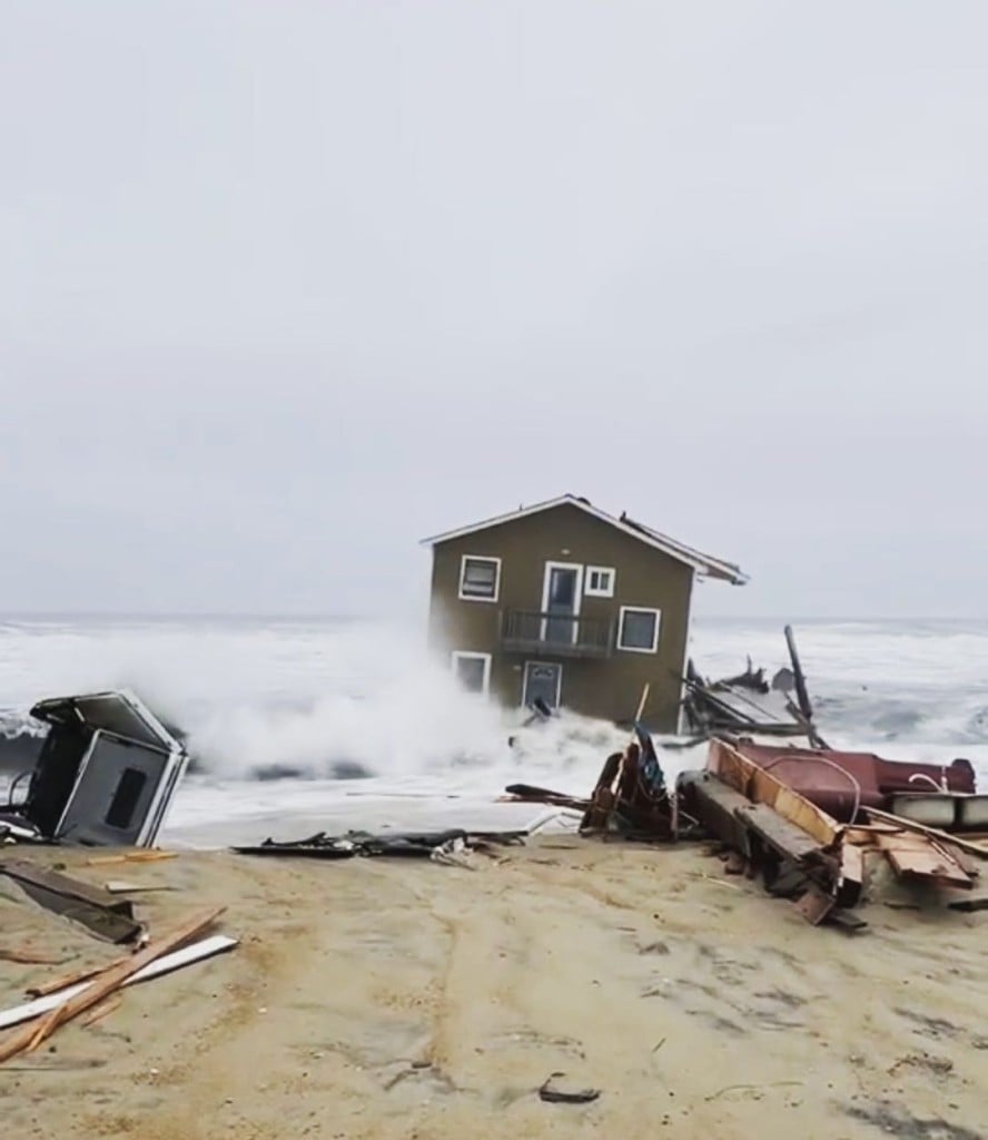
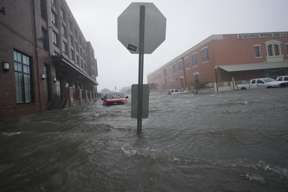
The Atlantic Ocean has now claimed three homes in Rodanthe, North Carolina just this year.
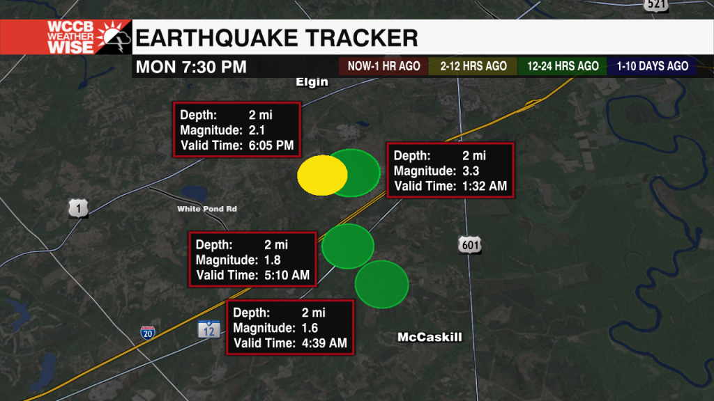
Over 2 dozen minor earthquakes have occurred in the midlands since December.
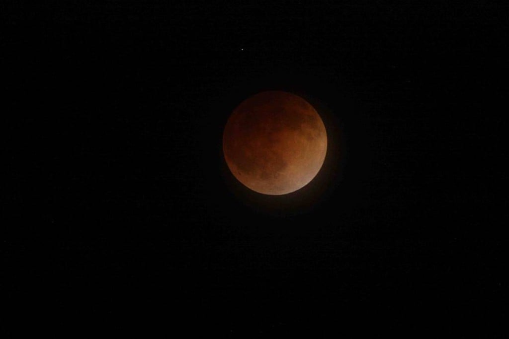
Parts of the United States (areas with clear skies) will be able to see a total lunar eclipse late Sunday into early Monday.
Several schools in the WCCB viewing area are dismissing early due to the possibility of severe weather Friday afternoon.
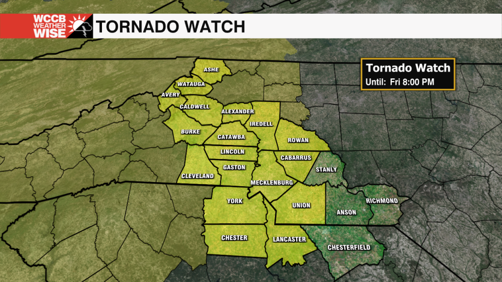
A line of storms will bring the threat of severe weather to the region this afternoon and evening.
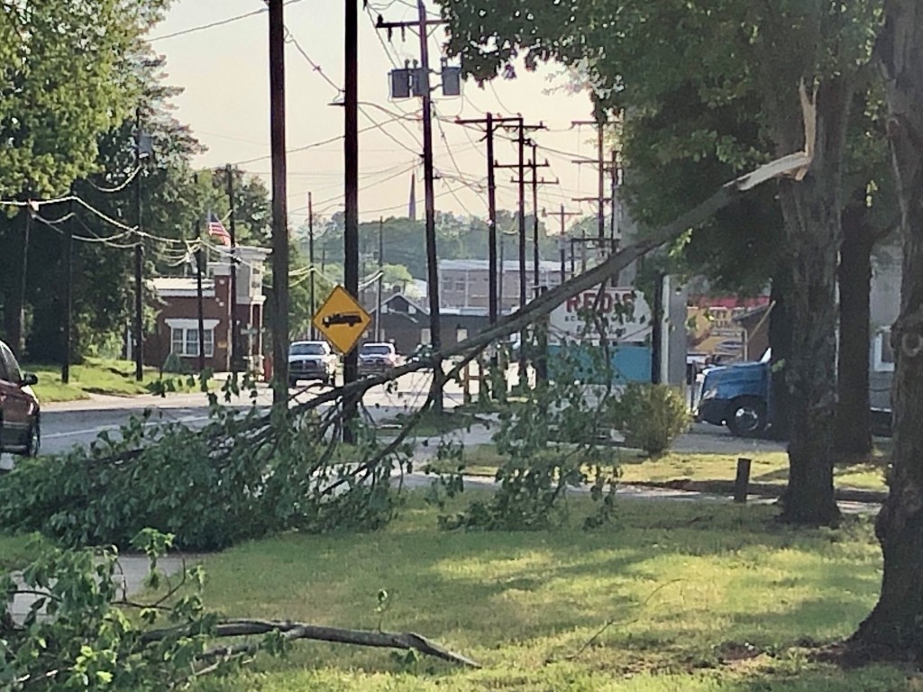
Duke Energy is reporting over 4,000 power outages in Mooresville due to severe thunderstorms.
Hurricane Preparedness Week is underway with less than a month to go until the official start of hurricane season.
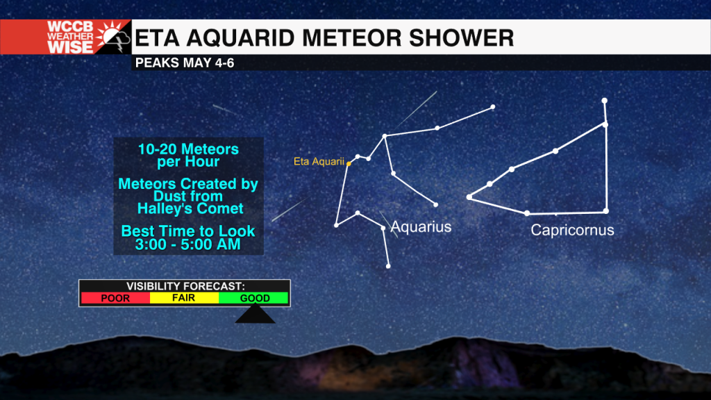
The meteor shower will peak May 4-6.
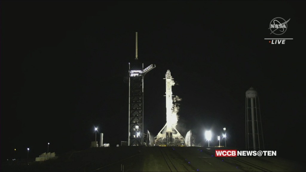
NASA astronaut Jessica Watkins is making history as the first African American woman to work and live on the International Space Station for an extended mission.
